South America Blog

   This is the journey I have always dreamed of,  to ride my motorcycle across the Americas. 

   Follow me as I travel south from Texas to the tip of South America on my BMW GS.   

    Here's a view of the Maps

Canyon del Pato

While in Chimbato, I took a side trip to the Canyon del Pato (Canyon of the Duck).  It was a 100 mile loop – 40 miles paved and 60 miles on dirt, rocks, and bigger rocks.  The loop had 48 tunnels and it followed a very narrow gorge and the Rio Santa, which flows into the Pacific Ocean.  This is where the Cordillera Blanco and Cordillera Negra mountain ranges come together.  It was a tough road to travel with a fully loaded GSbut,  I managed to make the pass without falling.  I traveled pretty much following the river bottom in the canyon, so you can imagine riding was mostly over rocks.  My average speed was 25 mph and I never got out of 1st or 2nd gear.  I rode the entire pass standing on my foot pegs as I did when I traveled to Cajamarca.  The difference between the road to Cajamarca and the road here in Canyon del Pato was that the road to Cajamarca was wide and mostly flat.  Here it was very narrow with one track to travel on and with no room to turn around or even move over for oncoming traffic.  I was lucky that every time I met oncoming traffic I was stopped to take photos and had enough room to let others go by.

With all the sever bouncing and beating the GS took the nut to the ball joint can loose again and I had to go really easy until I came to a village were I found a man who had the right wrench to help me tighten the nut.  

The GS repair shop

Sands of Peru

I was not looking forward to traveling the one hundred miles of rough gravel road from Cajamarca to the Pan American highway, since I knew what to expect, more or less.  However it seemed it was a little easier to travel this time.

I had a couple of scary moments when I encountered a couple of Lorries traveling in convoys up the mountain in groups of four or five.  As they blazed up the mountainside road they would create “white outs” with clouds of dust and sand.  The clouds would be so thick that I was not able to see anything in my path, including the road.  It would have been a long way down to the bottom of the mountain if I had gone off the edge of a cliff.  The return trip to the Pan American Highway took me approximately three hours.

To this point most of my trip had been traveled in mountainous areas with green jungles or forests.  Now I was in a treeless desert with bare mountains and sand dunes.  It was an amazing change.  It also seemed that the trash along the road was not as bad as before.  The cross winds were strong in the desert and at times the sand would build up on the highway.  Work crews would scoop up the sand with tractors as if it were snow.

I finally reached the City of Chimbote, on the Pacific coast, and called it a day.

IMG_1535.jpg

It's in the hat

When riding into Cajamarca it was hard not to notice the large hats that were being worn, mostly by the women.  The hat is a simple straw hat, but boy, are they large!  According to the locals, the purpose of the hat is to protect against the sun, and of course, also a fashion statement.  Young and old wear them.

There are 337 burial niches carved into the volcanic rock around Cajamarca.  They were used as secondary burial sites for the Cajamarca Khans or high ranking families.  When a person died they were buried in the ground for a period of one year.  Then they would be dug up and transferred to one of the niches.  When the Incas controlled the region many years later, they used these niches as places to store grains and seeds. These burial niches have a very interesting history in the Cajamarca region.

Ventanillas de Otuzco, Peru

Cajamarca, Peru

I departed Piura early on my way to Cajamarca.  After traveling only two miles the Peruvian police saw me approaching and, sure enough, they pulled me over.  I thought to myself, here we go again.  I pulled over and as the officer approached, and before he could say anything I stuck out my hand to shake his hand and said, “Buenos Dias. Como amanecistes?” (Good morning.  How are you this morning?)  He looked at me a little surprised and he said, “Fine. Where are you going?”  I told him that I was trying to get to Cajamarca and asked if this was the right way.  “Yes and no”, he replied.  “it is the right way but the long way.”  I asked, “What would recommend?”  He told me that the other way is best.  “Great,” I said.  “I shall go that way.”  “Oh!” I said.  “May I take a photo of you and your partner?”  “Yes,” he said. I took the photo and off I went and kept on going.

Peru National Highway Police

The recommended road was a pretty ride across the desert with sand dunes and mountains that were almost entirely covered with sand.  However, it is very sad to see so much trash along the side of the road.  Trash in Peru is a serious problem.

To avoid speed traps I rode a slow 150 miles on a straight road.  I just wanted to take my time and avoid getting stopped.  Although I was traveling slower than normal, I was still making good time.  When I came to the turnoff for the last 100 miles, I discovered the road was gravel and not a nice paved road as my map indicated.  Instead it was a rocky, bumpy, and dusty road.  The road rose from an elevation of 10,000 to 10,700 feet.  It was a pretty road but between the traffic, dust, and construction, I was more than ready of get off the road and call it a day.

Once I settled in Cajamarca I took a nice walk in this interesting colonial city.  The history of the city goes back 3,000 years, long before the Incas ruled the area.  It was here in Cajamarca that the Inca Empire came to an end at the hands of Francisco Pizarro.

In 1552 Atahualpa, the last Emperor of the Incas, came to Cajamarca to meet with Pizarro, the Spanish conqueror, in the Plaza de Armas.  Instead of meeting with Pizarro,   Pizarro had Atahualpa captured and imprisoned.  Atahualpa was imprisoned in a medium sized room.  For his release  Pizarro wanted Atahulapa to fill the room he was being held in with gold and twice the amount in silver.  Pizarro accepted Atahualpa’s offer and Atahualpa provided the gold and silver as promised.  However Pizarro, being the nice guy that he was, executed Atahualpa and took the gold and silver to Spain.

The actual room were the Emperor Atahualpa was jailed and also the room that was filled with gold and silver.

 Pizarro and Atahualpa
  when two worlds clash

Welcome to Peru

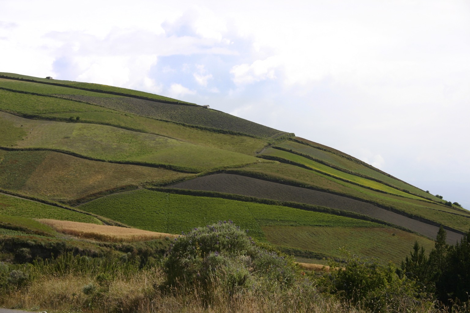
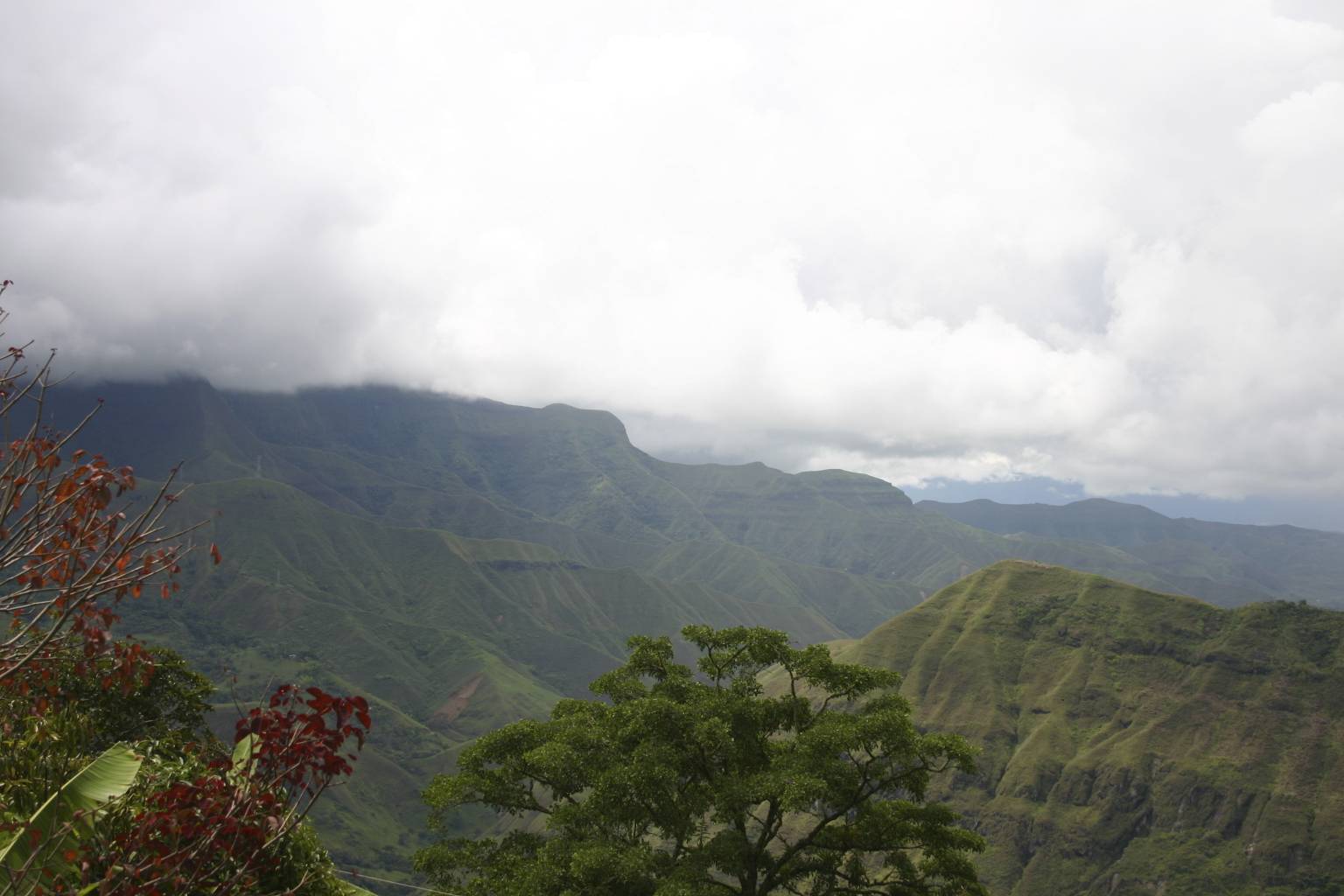
My ride to the Peruvian border was like just another day in the office.  I left Cuenca early in the morning and headed south for approximately 250 miles.  I traveled past some beautiful mountains and valleys on twisty roads at elevations from 10,000 to 12,000 feet.  It was a great day.  The mountain air was cool and the vistas were amazing.  The ride had some challenging road conditions.  I also encountered some road construction which was not too bad; however, the road conditions in these areas were a bit scary.  For what seemed like hundreds of miles, the road was being paved with concrete.  There was approximately a one foot height difference between the lanes.  This required me to travel in one lane only.  The traffic was not controlled in most areas, therefore I would be riding, enjoying the view, and then all of a sudden there would be oncoming traffic with very little room to move out of the way.  In those areas when the fog would roll in, it would really get scary because it was difficult to see oncoming traffic or traffic approaching from behind.

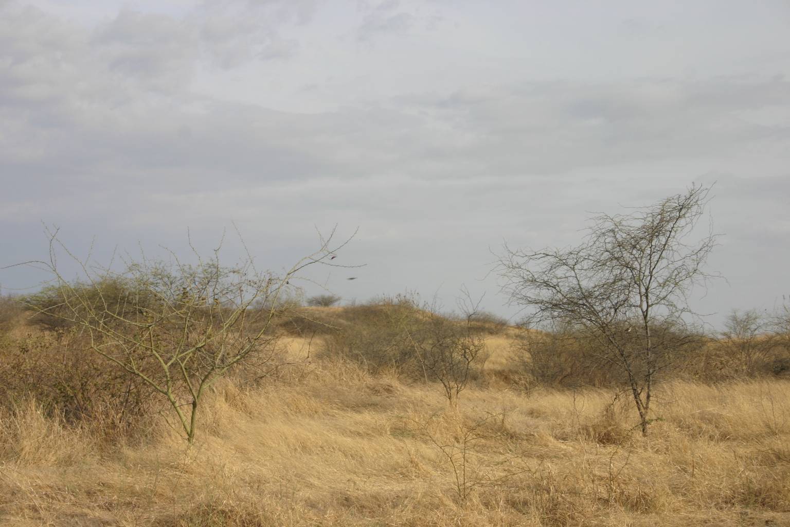
I started a slow descend from the higher elevations to the warmer temperatures after passing the City of Loja.  The landscape changed from lush green forests to dry brown desert grasses and trees.

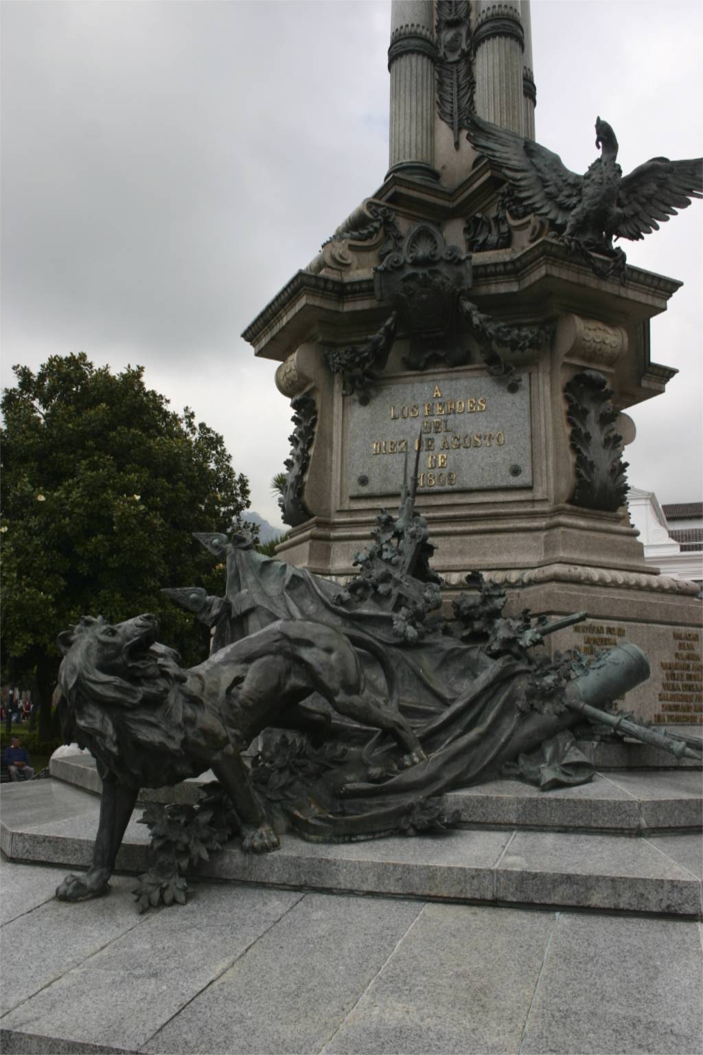
I was glad to see that the Ecuadorian - Peruvian border facility was a small one.  The exit from Ecuador was easy and the entry into Peru was just as easy. Officials on both sides of the border were very nice and helpful.  Border officials in Central America should take note.

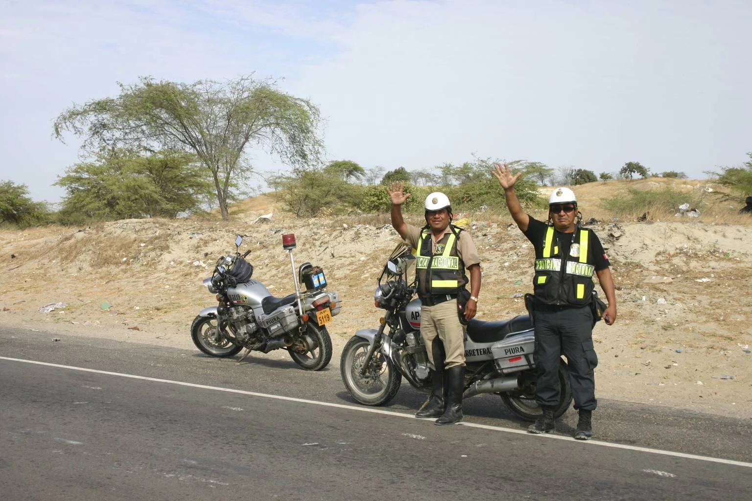
I heard many negative stories regarding the Peruvian police scamming motorcyclists for money.  The Peruvian police are aware that most motorcycle travelers are from outside the country.  They also believe that they carry lots of money with them.  One of their scams is that they request the rider’s driver’s license and import document.  Then the police hold the riders hostage and want them to pay a ransom to get their documents back.  While at the border I asked the Peruvian officials if there was anyone else that I should show my documents to while in Peru.  Their answer was very specific. They informed me that only customs officials are required to see your documents. DO NOT let anyone else handle your documents, and make sure that you do not lose them either.

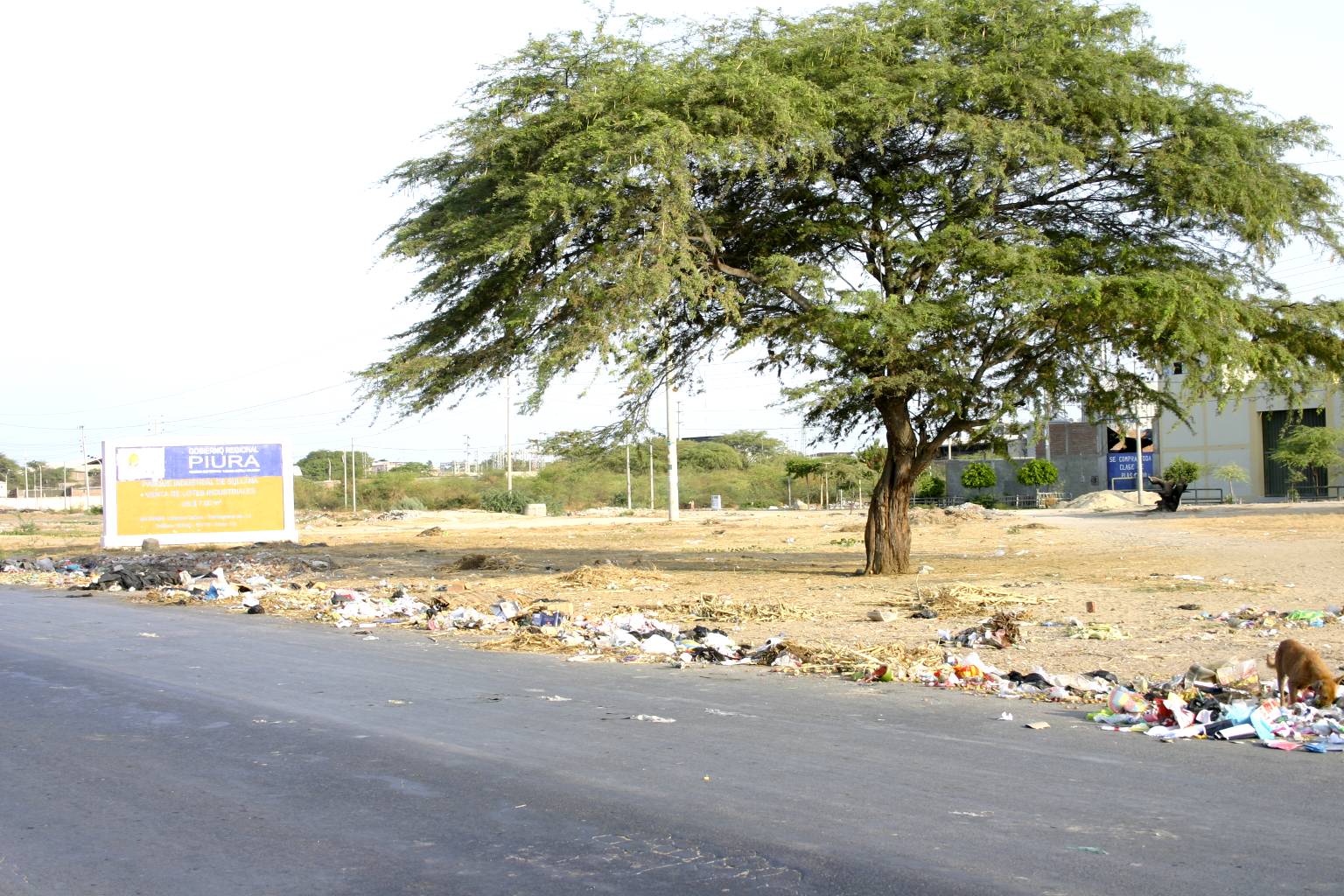
Sometimes after crossing a border the changes from one side of the border to the other are dramatic.  Poverty in Peru seems to be much higher.  There was trash everywhere you looked.  I am not talking about a little trash here and there.  The area looked more like a landfill.  The lush green mountains were replaced by hot, dry, brown, dusty countryside, much like west Texas.

With the knowledge that the Peruvian police could be a problem, after departing the border area I traveled extra carefully and slowly towards my next stop.  Sure enough, approximately 30 miles from the city of Piura I came to a police check-point and, of course, I was asked to pull over.  So I knew that they would try their ‘let me see your documents’ scam on me.  After pulling over, a police officer approached me and informed me that I had crossed the double yellow line.  NOT TRUE, of course.  He requested to see my driver’s license, which I handed over (a copy).  Next, he requested the documentation for the GS which I refused to hand over.  He informed me that he was the National Police and must see my bike documents.  I told him that he had no right or need to see the GS documents.  He started to get a little excited but I held my ground and refused to hand over the documents.  We kept going around and around this issue.  Finally I decided to show him the documents but not hand them over.  So I opened the documents as a scroll and I held onto them with a death grip.  Of course he wanted me to hand the documentation over to him to hold in his hands.  I refused to let go of them.  I said to the officer, “You can see the name, VIN number, and the two Seals of Import.  He stared at me and I stared back at him and finally he handed me my driver’s license back and I was on my way.
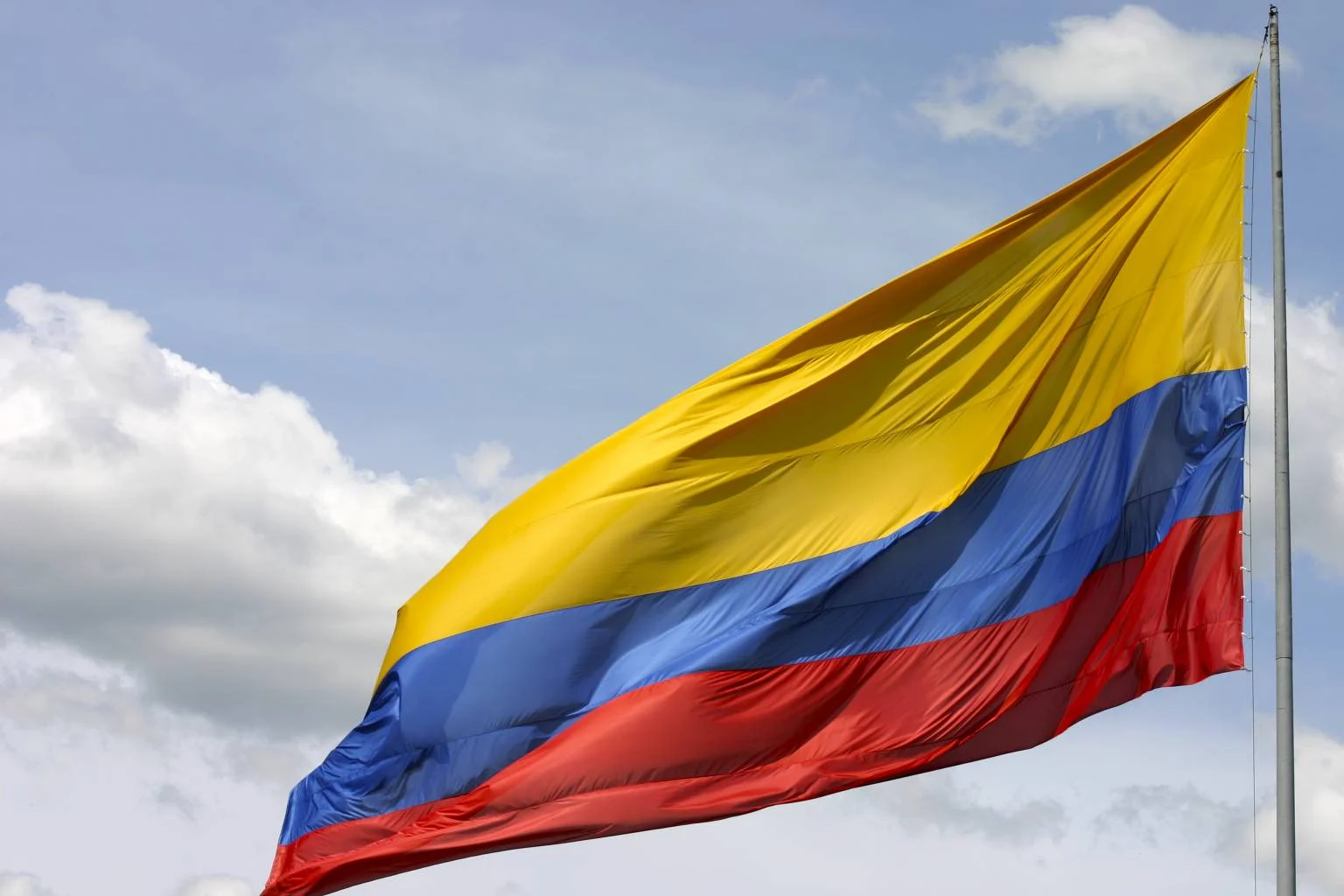
“Welcome to Peru.”

Trash is everywhere

Very West Texas Like

Cuenca, Ecuador

I arrived in the Colonial City of Cuenca just as it started to rain.  It was amazing to see that there were dark clouds on one side of the city and sunlight on the other.  This made the cathedral domes and the red tile roofs glisten from the sunshine.

Cuenca is a UNESCO World Heritage site.  The history in Cuenca goes back to before the Spanish conquered the Incan Empire.  Today, Cuenca has a colonial feel with cobblestone streets and aged red tile roofs on many of the buildings, much like the city of Antigua, Guatemala.

In the many markets you can find anything from shoes to fresh fruit.  

Some market shots

Getting to Cuenca

In Banos this morning, for the first time in such a long time, the sky was clear without clouds to block the views.  From my location I could see all three volcanoes – Tungurahua, Chimborazo, and Cotopaxi with its snow cap.  Cotopaxi was approximately 80 miles from my location and the thought of racing to it to take some photos did run through my mind.  However, that was easier said than done.  I was disappointed that the time that I was there all three volcanoes were covered with low hanging clouds.  I also feared that if I did race to Cotopaxi, by the time I traveled the eighty miles the clouds would have rolled back.

So I headed south on the Pan American highway towards the City of Cuenca.  I followed the ribbon-like road over the many hills and valleys with beautiful patches of different types of green grass fields.  Most of my ride was at an evaluation of between 10,000 and 12,000 feet above sea level.  At times it would get a little cold for my thin tee shirt.

Along the way I saw many native people standing alongside the road begging for money.  At a road construction site I had to travel about a mile winding down a hill and native people would hold ropes across the road to try and stop traffic to charge a toll.  The large Lorries would not stop or even slow down.  I just stayed as close to them as possible and would sneak by with them.  There were approximately 20 to 25 of these makeshift toll stops in this area.

After traveling a while I started to see more native people working in the fields.  I decided to stop and take a few photos.  Life is much harder in this area since the fields are located on steep angles on the side of a mountain with cold winds always blowing.

Day Ride

I decided to spend my day riding around the Chimborazo volcano which is Ecuador’s tallest volcano with an elevation of over 20,000 feet.  I rode my GS to an elevation of 14,500 feet.  It was great to ride above the timberline were it was extremely quiet.

IMG_1005.jpg

Notice the Altitude at the lower right of the screen

Even at this high elevation I saw native people working their livestock.  I tried to photograph some of them but they do not like having their photos taken and I have learned to respect that.  I also spotted several Guanacos roaming the countryside.

After traveling about three quarters of the way around Chimborazo I spotted a small country lane.  I followed it to see where it would lead me.  It was amazing to see that the mountain sides were covered with a patchwork of vegetation.  It did not matter what the angle or height of the land was, there was something being grown in it.  Space is not wasted in this part of the world.

After traveling a distance I was facing Tungurahua, the active volcano that had released steam and ash earlier.  I was now viewing it from a different side.  I stopped to take a few photos and while waiting for the cloud cover to clear, two very young boys and little girl approached me.  I asked them what they were doing and they replied that they were taking a break from work.  They also wanted to inform me that I was looking at Tungurahua and if I waited a while I could hear the roar coming from within the volcano.

Herbert is on the left and Fernando is on the right, I did not obtain the little girl’s name.  Tungurahua is in the background.

Ring of Fire

I rode to the Village of Banos, located at the base of the Tungurahua volcano.  Tungurahua is active and is always venting stream.  When I arrived at Banos it was cloudy.  I able to see the mountain sides but not the tops.

A few weeks prior to my arrival another volcano named Chimborazo, located in the general area, had some activity.  It released steam and ash, resulting in some of the villages having to evacuate.

A third volcano in the area, named Cotopaxi, has a beautiful snow cap.  The first time I rode by Cotopaxi I was not able to see the top due to the low level clouds.  However, I found it necessary to return to Quito to purchase parts for the GS.  As I rode by Cotopaxi there was a small window without cloud cover and I was able to see the massive volcano with the white snow cap.  Before I could get my camera and take a photo or two the clouds quickly moved back in and hid the giant volcano again.

In this area there is a road called the “Road of the Waterfalls.”  It runs to and ends at the City of Puyo.  From Puyo east you are facing the Amazon jungle.  In the Village of Puyo there are several outfitters and guides who will take you into the Amazon for a day trip or longer.  Going into the jungle requires one to carry all his/her supplies both in and out.

The ride to Puyo was interesting.  It was amazing to see the landscape change from mountainous to heavy jungle.  On my return trip from Puyo to Quito I discovered that one of the fork seals on the GS had blown.  Hence the return trip to Quito.

A quick tease from Cotopaxi

 The start of the Amazon in Ecuador

Telling the story of the machines devastating the forest,  its animals and peoples.

                                      Santuario Virgen de Agua S…

Navigating Quito

IMG_0758 - Version 2.jpg

Francisco de Orellana, a cousin of Francisco Pizzaro (the conquistador who conquered the Inca Empire in Peru), was the Spaniard who came to Quito in search of El Dorado, the city of gold.  Quito was located on the northern edge of the Incan Empire.  The Inca in Quito also fell to the Spanish.  Even today the locals seem to feel that they could have done without the Spanish, as evident by the brick on Orellana’s statue.

Juan Carlos took me to an overlook on a hilltop and showed me the trail that Orellana traveled on his way into the Amazon in search of the city of gold.

Quito is divided into two sections – Northern and Southern Quito.  North Quito is where the wealthy live, and South Quito is where the working classes live and where all the industry is located.  The divide between the two is the center of Quito, a section known as Colonial City. 

The historic colonial section of the city is where the Presidential Palace is located.  There is a street known as the Crosses because there are seven churches located on that street.

La Plaza De la Independence has a monument for the heroes that fought for independence from Spain.  There is a beautiful statue with a lion on the base (indicating Spain) with an arrow in its chest and broken chains.

The valley the conquistadors followed in route to the amazon

 Mitad de Mundo.

Quito and the Equator

As I traveled to Ibarra, the first city in Ecuador, I noticed some shaking of my GS when I applied brakes.  I spent the night in Ibarra.  The next morning I checked out the GS to try and figure out the reason for the shaking.  I discovered that the trailing arm ball joint was loose.  Off I went searching for a repair shop that could help me resolve the problem.

I located an auto repair shop that worked on European cars.  I walked in, explained to them that I needed to tighten the nut that held the ball joint in place on my GS.  They got the right size wrenches out and we took off the ball, inspected it and reinstalled it – making sure that it was real tight.  After all that work they did not charge me!  I can guarantee you that this would not occur in the States.  They were very nice people.

After repairing the GS, I headed to Quito and the Center of Planet Earth.  I saw several markers along the way.  Some markers were simple signs; others were globes indicating your location.  I arrived at the Mitad Del Mundo” (Middle of the World) monument.  According to my GPS the monument is a bit off the true mark.  Therefore I rode down the road until my GPS read N 00.00.000 and if I moved just a few inches south it would read S 00.00.000 indicating that I was now in the southern hemisphere. 

I spent some time taking photos of the area, and then I was off to the Capitol of Ecuador – the City of Quito.  The roads in Ecuador are great – a paradise for motorcyclists.  Great vistas, snow capped volcanoes, etc.

In Quito I meet up with some friends that showed me around the city.  They also provided me with the area history and other local information.

This is Freddy and son who showed me the way to the hostel where I was going to stay.

Juan Carlos and his wife Veronica (below) showed me the city and surrounding areas.


Arriving in Ecuador

My helmet, gloves, and riding gear were still cold and wet from the rain the day before but I still managed to ride about an hour south of Pasto, Colombia to the Border town of Ipiales, on the Colombian side.  The day started out with some light rain.

When I arrived in Ipiales I heard of a cathedral that was build in 1916 over a river in a canyon.  The Cathedral de Las Lajas looked like a castle. It was difficult to take a good photo of the place.  It is one of those places that must be seen to really be appreciated.

After the side trip to see the cathedral it was time to face the reality of crossing the border.  The Colombian side was easy compared to the many other border crossings I had made thus far.  On the Ecuadorian side it was not difficult – just time-consuming.  There were about 100 people trying to cross along with me.  It took us about four hours of standing in line waiting to get our passports stamped.  Once inside the office it only took about ten minutes.  I believe the reason for the long lines was due to the political/diplomatic unrest between Colombian and Ecuadorian governments.

A few months prior, the Colombian military crossed into Ecuador to capture/kill some of the FARC leadership.  FARC is a Colombian Rebel Group.  This was done without them notifying the Ecuadorian government, which resulted in regional tension. 

After a total of five hours of jumping through hoops to navigate the border crossing procedures, I was on my way.  I was advised to visit the cemetery of Tulcan while in the area, which I did.  The cemetery has some beautiful sculpted cypress trees.  They are sculpted into different figures of the Inca, Aztec, and Greek gods.  Others are just sculpted into perfect squares or perfectly rounded shapes.  The cemetery is several acres large and guided tours can be arranged.

Jose one of the guides

John for British Columbia, Canada going north after already have been south.  He's been on the road for 3 month now and 3 more to go.

Heading to the Border

Riding from Cali to Pasto was supposed to be an easy ride with an anticipated travel time of six or seven hours.  With all the rain I had encountered I did not even look at the sky any more for signs of weather conditions.  I just went ahead and put on my rain gear.

To satisfy my hunger I stopped at a very interesting colonial town named Popayan.  I do not know the town’s history.  It had a beautiful square and a church.  I parked the GS next to the church and took a few photos when I caught the smell of some very good food.  It was coming from an Italian restaurant located at a nearby corner.  I decided to eat there and they did a good job of taking care of my hunger.  After a great lunch I walked back to the GS only to find a crowd of people watching over my GS.  The crowd was very interested in my GS – how fast it travels, how far I had traveled, and how much further I would be traveling.

The City of Pasto is located in the southern part of Colombia.  Pasto did not have much to offer compared to the other major Colombian cities I had visited.  This was the area that I had been cautioned about earlier and warned to be extra careful because of the rebel group called the FARC which is known to be very active in this area. 

By now it had become the norm in Colombia to have vistas that were unbelievable.  It was difficult to take it all in at one time.  I rode from the tropical area around Cali to mountainous country heading south.  The rain in the area had created very dramatic clouds that hovered just above the landscape.

Pasto sits at an elevation of just over 10,000 feet.  When I arrived it was raining hard and I was more than ready to get off the GS for the day.  I stopped at the best possible roadside hotel that had good parking for the GS and, hopefully had hot water. I was ready for a long, hot shower.

The view of canyons before Pasto, Colombia

Ride to Cali, Colombia

Wanting to avoid the traffic gridlock of Bogota I started early around 8:00 A.M. It was Sunday, December 14th so I figured that everyone would be attending church and traffic would be light.  As my luck would have it, it started to rain as soon as I got on my GS.  I was told to head south on the freeway and then follow the signs to Cali.  I rode south on the freeway for a few miles without ever seeing any signs that indicated Cali.  I pulled into a gas station to top off the GS with fuel and asked for more directions.  The girl that was working the counter had no clue as to how to get to Cali, so I asked a policeman. He directed me back into the downtown area and then I was to make a right turn onto 30th street.  That was supposed to be the correct way to Cali.  I did as directed and I found that 30th street was a dead-end street with hookers and scary drug folks all around. 

I turned back and headed north towards the freeway again.  I must have asked 30 people for directions, everyone knew of Cali but it seemed that no one knew how to get there.  In addition to getting no help from the locals, it was “Bicycle Day” which meant that many of the streets were closed to regular traffic.  After an hour or so zig zagging my way around closed streets I was able to get out of Bogota.  So much for the early start.  Once I was on the countryside the road was beautiful.  Like most of Colombia – the vistas were fantastic.

I was to travel 300 miles to Cali.  It was raining and traffic was very slow which meant that I would have another eight to ten hour ride.  There was a segment of road in which I felt like I had traveled 60 or 70 miles in an hour.  The reality was that I had only traveled 22 miles!  Most of my travel was at elevations from 8,000 to 11,300 feet.  The rain became a light drizzle while traveling over the highest mountain passes.  After crossing the mountains the elevation dropped.  Once I reached the town of Armenia it seemed that the skies just opened up and the rain just poured very heavily for the next three hours.  The good thing was that since I was traveling in a valley this section of road was flat. 

Approximately 70 miles from Cali I rode up on a couple traveling on a large Suzuki motorcycle.  I would pass them and they would pass me. This continued all the way to Cali.  At a stop they asked me where I was from and where I was going.  I told them.  I mentioned to them that I was in search of a hostel but I had no idea of its location.  They offered to escort me to the hostel and would not take ‘no’ for an answer.  I followed them, located the hostel and the couple on the Suzuki disappeared.  I did not get to thank them.

The hostel is called Casa Blanca and it is run by Mike and his family.  Mike has traveled many of the same roads that I have traveled and roads that I will be traveling soon.  He was a wealth of information for us travelers.

Mike from Casa Blanca Hostel

Mike mentioned that I should visit the Asturias Motorcycle Shop located just down the road from the hostel.  The motorcycle shop is operated by Jorge and Sory, his wife.  They operate an independent repair shop that services many different motorcycle brands, including BMW.  There was an R1150GS in the shop with an electrical problem. I give them my two cents worth and hopefully it helped them. 

Both Jorge and Sory are very active with Horizons Unlimited and have a wealth of information on many areas of South America.  I want to thank them for their time, information, and tips.  It was all handy in my journey.

Jorge owner of Asturias in Cali

Day Trip to Zipaquira

I was supposed to meet the local BMW Riders Club for a day ride.  I got up ready to ride but the rear tire on the GS was flat again.  It seemed that the old puncture that had given me trouble in Nicaragua was leaking air.  I decided that I needed to replace the tire with a new tire.  Antonio, Jario’s father, volunteered to drive me to the local BMW dealership to purchase a new tire.  Before driving all the way across town I called the dealership in advance to make sure that they had a tire in stock.  So we drove there and it turned out that once there the dealer did not have the tire that I needed in stock.  After that little adventure we headed to other motorcycle shops however, while driving there Antonio spotted a Michelin Tire shop and we stopped.  I was convinced that they would not have the motorcycle tire that I need in stock.  To my great surprise they did have an Anakee tire in stock.  The cost was only $100.00 – cheaper than the dealer would have been.  I purchased the new tire and we drove back to the hostel.  I inflated old tire on the GS and road off to a nearby gas station to have the new tire mounted.  It took the attendant about ten minutes to mount the tire and the cost was a total of .90 cents US.

The tire situation took a half day to correct.  I decided to go see some sights before the rain started again.  One place I really wanted to see was the Salt Mine Cathedral which was located in the Village of Zipaquira.  Zipaquira was located approximately one hour north of Bogota.  However, from experience I knew that would really be more like a three hour journey.

Once I was outside of the Bogota City limits it was a pleasure to travel in the countryside.  The roads were twisty and the vistas were incredible.  The Village of Zipaquira has a beautiful historic plaza.  Around the plaza were markets, vendors, and you could see families walking with music playing in the background.

The Salt Mine Cathedral is located on the edge of town.  The Cathedral was built within the salt mine itself.  As I dissented into the mine I passed the fourteen Stations of the Cross which are carved into the salt walls.  The Cathedral is located almost six hundred feet into the mine at the end of one of the shafts.

Salt Cathedral of Zipaquira

Bogota, Colombia

Bogota is Colombia’s Capital City and, like most capitals that I have visited, they are big places, with heavy traffic and just plain madness.  Bogota was no different.  The population is seven million and the traffic was tough.  The problem was not crazy drivers, it was the vast number of drivers.  I could not get anywhere because I would become trapped in the traffic jams and would not be able to move.  Colombia had the most motorcycles I have ever seen in my travels.  There were thousands of people using 125cc or 200cc bikes.  I saw some amazing loads on these bikes.  For example I saw a family of five onboard one of these bikes.  I also saw small scooters pulling some sizable advertising signs on trailers behind them.  Therefore, trying to get around on a motorcycle was very difficult and slow.  My guess is that approximately 80% of the police in Bogota were 2 up on a motorcycle.  Everyone seemed to ride, rain or shine.  If raining, the rain gear came out and life goes on.

My first day in Bogota was spent working on my GS so I did not see much of the city.  On my second day my friend Jairo and his family were hoping to take me on a day trip to the inner city.  However, the rain started and traffic was not moving at all.  We spent five hours stuck in the car with traffic not moving an inch.  Late at night, once the traffic had subsided, we were able to see some of the city sights.  The Simon Bolivar Plaza was decorated with bright Christmas lights.  The plaza is in the center of the city with all the government buildings.  City Hall on one side, the Justice Hall on the other, and the city’s Cathedral on another side.  Security was high.  When we entered a parking lot it was required that the hood and trunk be open for inspection.  Security officers scanned the underside of the car with mirrors, as well.

  My Friend Jairo

Jairo's father Antonio

Bogota Cathedral

Simon Bolivar Plaza

Repairs Needed

I traveled from Medellin to Bogota Colombia without incident.  It was a 250 mile ride.  I was stopped a couple of times for document checks by the police and/or military. At a check point I was informed that it was not long ago that the roads in the area could not be traveled because of guerilla or bandit activity.  Today things are safer throughout most of the country.  The police and/or military are everywhere and it is difficult to tell the difference between the two services since they both wear the same type of uniform (army green).  In the lower jungle, between Medellin and Bogota, the security presence is very heavy.  There are small military groups stationed approximately every one and half mile along the road.  They stop traffic to inspect cars and people.  At one point I stopped along side of the road to take a few photos and I did not notice that there were two military guys standing about ten feet away from me and about a foot into the jungle vegetation.  They blended into the jungle so well that they seemed to be invisible.

I was warned by the military and police to be extra careful once I approached the Ecuadorian border.  The military officials indicated that the area close to the border had a lot of hot activity.  My assumption was that he meant guerilla activity.

I traveled at a good pace to Bogota except for the last 60 miles.  The last 60 miles took me approximately two and half hours to travel.  Between climbing the mountain passes, heavy truck and bus traffic, and construction, the last leg of my ride took what seemed forever.  As I entered the city it started to rain.

I was to meet a friend at a repair shop to do some maintenance on the GS – oil change and an overall inspection.  During my inspection I discovered some damage to the rear factory tail rack.  I had a backrest attached where the pillion seat normally goes.  The rack had broken completely into two pieces and I also noticed that a very small crack had started on the frame of the GS.  I believe that maybe the spare tires I was carrying may have been bouncing a lot on the many bad roads traveled, adding stress to the aluminum rack, causing it to break. 

With the help of my friend Jairo, we located a welding shop that was just down the street.  The welder touched up the crack on the frame of the GS and welded together the broken tail rack, adding some extra support.  One thing that I admire about people in these countries is that they do not know how to say “No. It cannot be done.”  They will fix or make almost anything to solve a problem.  Just before I left on this trip I had a cylinder guard that needed to be welded.  I had such a difficult time finding a welder to do that simple job.  In the area where I live there seems to be a welder at every corner, but to get them to agree to fix an item is very difficult, if not impossible.  It seems that they always have a reason (excuse) as to why it cannot be done. 

Once the welding repairs where completed I put everything back together on the GS and was ready for the next leg of my trip.

Fixing the Crack on the frame

The tail section after the weld,  not pretty but it works.

Medellin Colombia

I spent my day sightseeing in Medellin and also a day to give my GS some needed attention.

During my return trip from Cartagena I noticed that the GS was having trouble when I applied full throttle to pass slow moving traffic.  I also noticed that the fuel pump sounded weak. It did not seem to have the loud buzzing sound that I am used to hearing.  Like the spare hall sensor, I was also carrying a spare fuel pump for those “just in case” scenarios.  The pump in my GS was the original, and after 434,000 miles of work it was starting to get weak.  So I decided it was time to replace it with the new one.  The new fuel pump sounded much better and the GS ran much better as well.  The thought of contacting BMW to see if there was any warranty left on the old ran through my mind.  One would think that it should have lasted a little longer!

Once the GS was squared away I took a cab to the City Centro to explore the Botero Plaza area.  Fernando Botero was born in Medellin in 1932 and is a famous Colombian painter and sculptor.  His paintings and his sculptures are known for his “Large People”.  Botero Plaza has several of his sculptures on display and for children and people to play on, climb, or just have a photo taken next to them.  His paintings are in the Museo de Antioquia located just across the street from the plaza.  The Museo has some really cool stuff.

After the museo, I took a quick trip to an overlook that sits on the top of a hill located within the village of Cerro Nutibarra.  Cerro Nutibarra is a re-creation of a typical Paisa Village which is common in Colombia.  It is a tourist trap but interesting to see and it does have a great view of Medellin.

Botero Sculptures

Typical Paisa Village

The Ride Back to Medellin

In an effort to not repeat riding in the dark, I decided on a real early departure from Cartagena.  Actually the return trip was not as bad; however, seeing the section of road approaching Cartagena in the daylight was an eye opener.  I had traveled this section of road in the dark and I was amazed that I had been able to make it without any major incident.  The potholes on the road were huge. I was just lucky.

Not wanting to waste time, I was only stopping for fuel.  I did not take many photos although there many beautiful sights along the way.  I only encountered one check point. It was still a long day but I managed to travel the return trip in 10.5 hours.

I witnessed something that a motorcyclist never wants to see.  That is the crash of a motorcycle with another vehicle.  It happened as I came over the crest of a hill, just past a military check point.  I noticed a store/restaurant at the top of the hill and I was looking to my right searching for signs of a gas pump.  As I turned my attention back to the road, out of the corner of my eye I saw the flash as a minivan quickly pulled into the parking lot of the store.  The driver of the van never saw the oncoming motorcycle which was driven by an older man on a 125cc motorcycle.  The motorcycle hit the van at full throttle broad side.  I immediately pulled over and the military guys from the check point came running over to help.  One of the military guys stopped a farmer in a small pickup.  They loaded the motorcyclist onto the pickup and took off.  Everything occurred in a matter of five minutes or less.  The motorcyclist was wearing a helmet which seemed to be pretty old.  He had cuts from the broken glass.  Some of the people in the van seemed to have cuts as well.

In most of these countries the roads are narrow and heavily traveled; therefore, when an accident like this occurs it is cleared fast or traffic just pushes past the accident.

After that bit of excitement I pushed on to travel the last 150 miles which were the most beautiful because they were up in the mountains.  I was extra careful on this section of road because the road was heavily traveled and Lorries often moved into your lane while cornering curves.  I was prepared to make quick decisions as to which way I was going to head in order to avoid hitting oncoming traffic.  To add a little more stress, heavy fog rolled in, slowing traffic even more.  All in all I still made good time and arrived at the hostel safely.  

Cartagena, Colombia

What a difference a day makes!  The night before I was totally exhausted and the parts of the city that I saw did not look like it was worth the hard ride to get here.  Today, after a good night of sleep, and in the daylight, things looked very different.

The City of Cartagena is located in north eastern Colombia with the Caribbean as its waterfront.  Old Cartagena has a huge wall which surrounds it.  The wall was built to protect the city from pirates, the English, and the French, to name a few.  Today, within these walls are the best restaurants, shops, and other tourist type places.  Old Cartagena is a very beautiful place with narrow streets and many colorful buildings.  Next to the restaurants and shops are the local markets selling every kind of knick knack, street food, and fruits.  Cartagena also has a beach resort which reminded me of Cancun, Mexico, with a few super hotels.

While walking in Old Cartagena I saw a fellow GS rider coming around the corner.  I walked over and introduced myself.  His name was Javier and he was from Spain.  We talked for a while and he mentioned that he had traveled with an Englishman for a few days, but he had to suddenly end his trip and return to his family.  I thought for a moment and I asked him if the Englishman was named Steve.  Javier said yes, with a surprising look.  I told him that Steve had ridden with me and the group I had traveled with in Mexico a few weeks back while attending the BMW Motorcycle Rally.  Steve had mentioned to me that he had a friend from Spain that he hoped I could meet someday.  It is a small world after all.      

Javier from Spain