South America Blog

   This is the journey I have always dreamed of,  to ride my motorcycle across the Americas. 

   Follow me as I travel south from Texas to the tip of South America on my BMW GS.   

    Here's a view of the Maps

The Second Day

We spent the night in the small village of Camp End.  It is located on the northern end of Laguna Colorada which gets its name from the red color of the water.  The microrganisms in the water give the lake its red color and also gives the flamingos their reddish/pink color.

Camp End is nothing more than a stopover for the 4x4 tour groups.  There is no electricity and a very limited water supply.  The only food available is whatever they had that day.  In the mornings the winds are still, but in the late afternoons and at night the winds generally are strong, fierce, and cold.

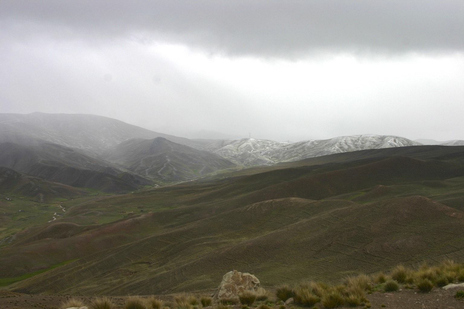
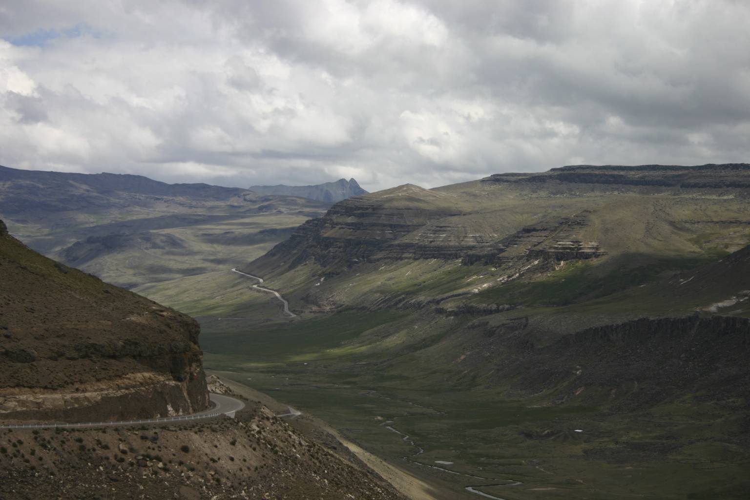
We decided to get a late start to allow the sun to warm up the air temperature and our bikes did not like sitting outside in the cold overnight.  The day started where it had ended the day before, more sand and two very tired bodies.  Vistas in this area were just beautiful!

I started my day slowly and easy I was still very sore and weak from the ride the day before.  I had another fall trying to change tracks.  I just did not have the strength to muscle the GS over to a new track.

The wind started blowing very early and the fight was on again.  We decided to go see some geysers and also Laguna Blanca and Laguna Verde.  We made a short stop at the geysers and continued to the two Lagunas.

As we traveled to Laguna Verde the sand started blowing and it was very heavy, making it difficult to see, and I was tired.  The surface was hard so handling the GS was not very difficult.  With that said I am not sure that I know what happened next – either the wind pushed me over or I softened my grip on the handlebars, but somehow I ended up drifting over to the center hump of sand which was about 18 inches high.  The front tire buried itself in the sand hump and I went flying over the handlebars landing on my back.  I was very lucky that no damage was done to me or the GS.  It was very difficult to upright the GS.  After getting going again we managed to make it to Laguna Verde.

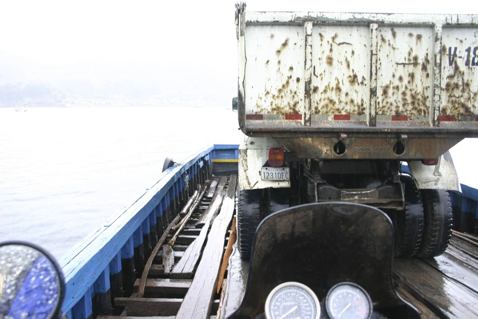
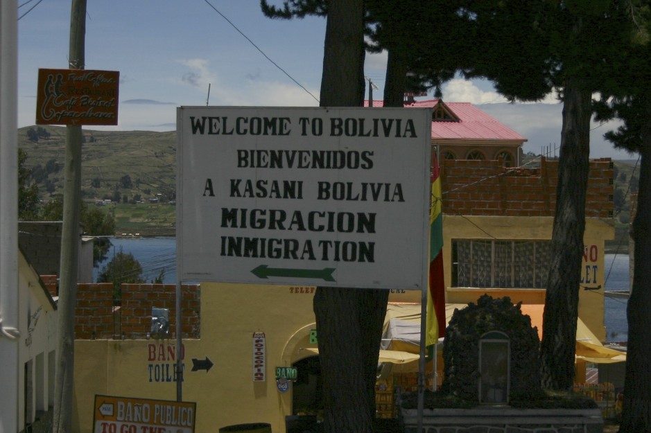
After we visited Laguna Verde we started our search for the Bolivian Immigration Office.  The Bolivian Customs Office was our first planned stop once we were able to locate it.  The Customs Office is in the middle of absolutely nowhere.  It was located at an elevation of 16,500 feet.  Like the Customs Office, Immigration was also located in the middle of nowhere.  After a few minutes we were out of Bolivia and into Chile.

Flamingos, a Stone Tree and Sand

Kevin and I left Uyuni and started our adventurous ride.  Believe me, an adventure it was!  The road was wide and fairly well maintained for the first 100 miles. 

We arrived in the small village of San Cristobal which was the last place on our route with a gas station.  From San Cristobal we traveled toward the southwest for approximately 40 miles.  There we took what looked like a dirt track, and according to our GPS waypoints, this was where we where to turn.  Keeping in mind that waypoints are only guides so we were not sure if this was the actually place to turn.  We spotted a cloud of dust in the distance that was coming our way.  So we decided to wait for them to arrive where we where and ask them if this was the correct track/road.  As the 4x4 approached I flagged them down and asked the driver if this was the way to Laguna Colorado.  He said it was.  “Great,” I said, and we rode off.  The road turned bad almost immediately.  For a 4x4 vehicle the road is not bad to travel on; however, for my GS, which had a full load of gear weighting about 800 pounds, it was completely different.

We traveled on this road slowly and easy, having to focus on the road with no glance at sightseeing.  From the top of a hill we could see the first of many lakes.  This lake had flamingos hanging out feeding on the microorganisms found in it.

Very small pebbles covered the area around most of the lakes.  Each lake seemed to have a different color pebble.  When I first saw the pebbles I thought that they were packed tightly, but in fact, they were very loose and the tires on the GS would just sink into them making it very difficult to maneuver.  Since it was early and I was still full of energy I said to myself, ‘no problem.’

A few miles later we came to an amazing valley to see from a distance.  The valley was mostly loose black pebbles.  I tried to travel on top of the 4x4 tracks; however, the tracks at times had center humps that were as high as 12 to 15 inches.  Sometimes the rear tire would hit solid ground causing my GS to fishtail.  At one point I got into a fishtail that seemed to last forever.  I have been told that if you get into a fishtail situation, stay on the throttle.  In this case, I was gaining speed and bouncing from rut to rut.  I came very close to having a serious crash.

By late morning the 15,000 foot elevation started to have an effect on both of us.  It becomes very difficult to breathe, and we were just plain exhausted.

15000 Feet Above Sea Level

While traveling slowly I experienced my first tip-over (fall).  The front tire of my GS got caught in a tall center hump.  With some effort, Kevin and I uprighted the GS.  There was no way that I could have uprighted the GS had I been traveling solo.

At mid-day we took a lunch and water break.  We were very close to a landmark that I always wanted to see – “El Arbol de Pierda” (the tree of stone).  I had seen photographs of this rock in magazines many years earlier, and when I learned that it was in Bolivia it became a must-see site on my list.  To me, it was like seeing the Grand Canyon in person.

After our break we headed out to locate the Arbol de Pierdra.   In actual distance we were less than ten miles from the arbol, but in reality it might as well have been 100

miles away.  The ten mile section of road had deep sand and very loose gravel.  It took us over two hours to travel those ten miles.  In addition, I had another tip-over.  I was traveling a bit faster than the previous time that I fell.  As before, the front tire got stuck in deep sand causing the GS to come to a sudden stop.  OVER I WENT!  As before, it took both of us a lot of effort to upright the GS.

Arbol de Piedra

We arrived at the Arbol de Piedra and I finally get to see and touch the wonderful landmark.

We were only 6 kilometers from the location we were going to spend the night; however, those last 6 kilometers challenged us hard.  The wind picked up and got stronger and colder as the day ended.

Hanging Out in Bolivia

Kevin and I decided to partner up and travel from Uyuni to San Pedro together.  We took an extra day to rest and re-check our list of necessary items that would be required for this dangerous leg of my (our) journey.  Food, water, GPS waypoints, and most of all, extra fuel were necessary items.  The distance to be traveled on this route was approximately 300 miles.  That was, of course, if there were no mistakes, and most importantly, if we did not get lost.

The major challenge was that there were no maps, or I should say, that the maps that we carried with us had little to no detail.  Additionally, there were no road signs that indicated direction or distance.  The best information we had was from other riders who crossed before us and from tour guides.  It seemed that everyone had a different suggestion on how to cross this desert; however, everyone was very clear about carrying extra fuel and not getting lost.

Not getting lost was much easier said than done.  Along the road there were hundreds of roads and tracks that just seemed to wonder off into the landscape.  Some riders would follow these tracks to dead ends or just wonder off for miles before realizing they were on the wrong road/track, using up fuel that one cannot afford to waste.

One other very critical thing about crossing this desert was DO NOT GET INJURED.  There is NO help and it could be days before anyone comes along.  With elevations of 14,000 to 16,000 feet the temperature drops to -30c at night.

After scaring ourselves for most of the day we decided to take a short trip to a train graveyard.  It was located just outside of Uyuni, I do not know the history of this graveyard but it was a cool place to hang out and take a few photos.

Bolivia, 2009

El Solar de Uyuni, Bolivia

I started my ride early to the remote southwestern corner of Bolivia towards El Solar.  The El Solar salt flats have the distinction of having the highest elevation in the world.  Frank and Gaby had indicated that this section of road was tough and would be a hard ride.  I found that long sections of the road were under construction and in some areas the ground was very soft, causing the GS to sink fairly deep into the sand.  In traveling alone the risk was tipping over and having no one to help upright the GS.

The road was extremely remote however the vistas were just amazing.  Arizona in the US has a resemblance in landscape colors.  The color tones of the landscape always changed.

Approximately two thirds of the way to Uyuni I stopped to take a few photos, and once again in the silences of the isolation I started to hear that familiar boxer motor sound in the distance.  Not more than five minutes later two adventure riders approached on their BMWs.  They were heading in the opposite direction.  They had ridden to Uyuni and were returning to Potosi.  They indicated that the road was difficult but could be ridden on a GS.

I finally made it to Uyuni.  It was a small, dusty town.  It seemed that the whole world came here to see the El Solar salt flats.  I stopped at the first hotel/hostel that I found.  To my surprise I came across two other adventure riders who were just about to leave on a ride to explore the salt flats.  Kevin, one of the riders, had been in contact with me via email.  He had provided me information regarding crossing the Uyuni to the San Pedro desert.  After checking in and getting a quick soft drink I headed for the Solar with them.  It was decided that we would not cross the Solar lengthwise because some areas had water.  Getting salt water on the GS is not a good thing.  Actually, salt water is nasty on anything that it touches.  Being out here in the middle of nowhere was not the time to introduce any problems.  Therefore, we rode fairly slowly and easy for a few miles.  We stopped and took photos to show that we had reached one of our milestones - Solar de Uyuni, Bolivia.

Kevin riding a KLR

Potosi, Bolivia

Like the city of Zacatas, Mexico, Potosi is a major silver producing city with a 500 year history.  It sits at an elevation of 12,800 feet, making it Bolivia’s highest city.

As I arrived in Potosi a heavy rain started falling.  The city had cobblestone streets and water raged down the streets as if a river.  As I searched for a place to stay for a couple of days I tried not to stress over the fact that the cobblestones can become very slippery when wet and very difficult to maneuver.

As soon as the rain stopped the city came to life once more.  I needed to replace the street tires with the knobby tires because from this point on I would travel on gravel, dirt, and sand.  I need to locate a Llantero (tire shop) to do that job.  The normal routine was that I would remove the tires from the GS and the tire shop would swap the tires and I would reinstall them.

When I arrived at the hostel where I was staying, I started to unload the GS when I heard a sound that only a BMW person recognizes.  That was the sound of another Boxer motor!!  I walked out onto the street to investigate and rediscovered my lost German friends Frank and Gaby whom I had lost track off a week earlier.

After cleaning up and relaxing in my room for a while I decided to wonder the streets of Potosi.  I met up with Frank and Gaby for dinner.  We traded stories of bad roads and the side adventures we took.  At dinner we were joined by another German traveler named Silke.

For some time I had been studying a road that ran from Potosi to Uyuni and from Uyuni to San Pedro de Atacama.  From the information that I had gathered this road would be a very tough ride on a heavy GS like mine.  The road is located in the middle of nowhere, with no real maps, no road signs, no fuel, and no help if needed.  It, however, has some of the most beautiful and spectacular landscapes in the world.  For many years I have been dreaming of riding this area.  I knew my limits and the conditions that I would encounter.  Frank and Gaby had ridden the Potosi to the Uyuni section of road.  They fell off their bike a couple of times and their comment was “never again.”  Silke had just crossed the Atacama Desert in a 4X4 with a tour company and was very honest about the conditions as well.  Her comments were “not easy,” “very easy area to get lost,” and “no one out there to assist you should you need help.”  So with those words of encouragement I told myself that I would study the course and the matter a bit longer.

My dilemma was that coming to and riding this area of Bolivia was one the main factors for me making this journey.  I really did not want to pass up the opportunity now that I was so close.  Besides I had just put the knobbies on the GS and I needed to ride on dirt somewhere.

Adventure traveler, Silke

Sucre, Bolivia

After completing all my computer work in Oruro I rode to Sucre, Bolivia.  The City of Sucre is a UNESCO World Heritage site.  It is a beautiful colonial city.  Sucre reminded me of several other cities I have visited on my trip.  Cities like San Miguel, Mexico; Antigua, Guatemala; and Granada, Nicaragua.  Sucre is known by four names but the one that I feel best describes it is Ciudad Blanca (the white city).  All buildings are whitewashed with red roof tiles.  The city had a very relaxed atmosphere with great restaurants, plazas, and markets.  The climate was also great – not too cold and not too hot.  The city is located at an elevation of about 7,000 feet.

I had a great ride from Oruro to Potosi.  I rode along the altiplano for the first 100 miles with the mountains on one side and pampas on the other.  The second 100 miles I climbed into the mountains on a twisty road.  This area reminded me of Arizona and Utah in the USA.  The scenery was a mixture of Monument Valley, Zion National Park, and the Painted Desert.  The colors in the valleys and mountains were rich reds, greens, and yellows.

It was a nice ride in a beautiful place with great temperature and no rain.  All that came to a halt when I was pulled over by the Bolivian police.  It was the same old song and dance.  They claimed I was traveling twice as fast as the speed limit.  Yes, of course they tell me “you have to pay” and I say “I have no money”, etc.  This carried on for about 45 minutes.  Finally they asked if I would give them a few bucks to purchase fuel for their patrol car.  All I had on me was 10 boivianos which exchanged to about a $1.40 US.  They gladly took the offer and we were both on our way.  I hated giving money like that because it only adds to their temptation of doing again to someone else.  However, they caught me on a good day and I happened to be in a generous mood.

Hanging Out in Oruno

My routine for finding lodging was:

  1. Private Room
  2. Hot Water (I always got a Si  but it was not true most of the time)
  3. Parking for the GS
  4. Internet access

If they had most of the above I considered it a good place to stay and I would take their room.  Since I had an extra day in Oruro I wanted a hotel with internet access so that I could do some of my online work.  It is difficult to do online work at an internet café because normally their computers are old and slow.

The hotel that I selected had all of the above and since everything was going to be closed the next day this was my opportunity to work on my website and also to get caught up on my emails.  I tried connecting to the hotel internet with no luck.  I had experienced some issues connecting to the internet ever since I had entered Bolivia.  I was not sure if there was a problem with the internet system in the entire country or if I was having a problem with my laptop.  My concern was that if I was having a problem with my Apple laptop, getting it to a shop would have to wait until I reached the next major city which was Santiago, Chile.  What a pain.  Nothing to do and no internet – a wasted day.

As the day dragged on I decided to take a walk.  Since the time was now approaching 5 P.M I wanted to locate a place for dinner.  On this little adventure I walked further than before.  I made a turn onto a new street and to my surprise there was an Apple Computer Store.  An Apple Store in Oruro, of all places – a small town in the middle of nowhere.  A place where I had a very difficult time locating fuel for my GS I find the only Apple Store for hundreds and hundreds of miles.  I walked over to the front door and happened to catch the owner, Fabricio, who was there to pick up something he needed.  We talked briefly.  He give me some ideas for troubleshooting and told me to stop by in the morning if I was still having problems.

The suggestions provided by the Apple store owner did not help.  First thing the next morning I was back at the Apple Store and I had him check out my laptop.  To my relief, my laptop seemed to be working correctly and it seemed the Bolivian internet system was very poor.  Fabricio was very generous by allowing me to do about three hours of work using his computers.  He also called up some of his friends who are experts on the Solar area of Bolivia.  I had been trying to research that area but had difficulty getting information.  Fabricio also helped me locate Sucre, the next city I was traveling to.

If you ever find yourself in Oruro, Bolivia and need an iPod or an Apple computer, visit Fabricio.


Oruro, Bolivia

Upon leaving Cochabamba I had to cross once again the mountain pass where I had encountered the sleet and snow a few days before.  Of course this made me nervous.  The fact that it was raining added to my worries.  I figured that in the mountain pass it would be snowing.  Anyhow, I departed Cochabamba and approached the mountain only to discover that it was warm enough that all I had was rain.

I saw people herding their sheep or llamas high in the mountains.  The air temperature was cold which made me wonder how the native people of the area handle this kind of weather.  On days like this, with cold rain and heavy fog, I would think that staying indoors by a nice cozy fire would be great.  People in this part of the world do not have cozy homes.  Most houses are mud huts with grass roofs, which most likely leak water.  Another sight that just gave me the chills was to see the young children playing and woman washing their laundry knee-deep in the cold streams.

Once I crossed the mountain pass, the weather started to clear a bit and the air temperature warmed up.  I arrived in the City of Oruro, the capital of the State of Oruro.  It was market day and also the eve of the Bolivian national election.  The atmosphere in town was very political.  The streets were full of people.  The main political issue was a constitutional change that President Evo Morales was pushing.

My plan was to stay in Oruro one night only; however, I was informed that because of the national elections the next day it would not be wise to travel.  All businesses were required to close and I would not be able to find fuel, food, or lodging anywhere.  With that information, I decided to stay and extra day.  I also decided to fuel up right away.  That way I would not have to waste any time searching for fuel the day I was to leave.  It took over two hours to find fuel.  Some stations were completely out and others had closed for the day already.  When I did find a station with fuel the wait lines were long.

Election graffiti could be seen everywhere.  “Si or No to Evo”         

In the end the "Si"s won.

Chasing Che

I decided to visit Cochabamba because I wanted to visit the nearby Village of La Higuera.  La Higuera is the place where Che Guevara was captured and later killed by the Bolivian military, with assistance from the CIA.  My Bolivian map seemed to distort distances.  According to the map the Village of La Higuera was only 100 miles east of Cochabamba.  I asked several locals for directions on the best way to travel to La Higuera.  They indicated that I should take the road to Santa Cruz and then turn off to La Higuera.  To get on the road to Santa Cruz I was to follow the signs from the center of Cochabamba.  I did as I was told by the locals.  I followed the signs to San Cruz from the center of town and everything seemed fine.  I was on my way!  I traveled approximately 100 miles (three hours) following the signs to San Cruz.  However, something told me that I was not traveling in the right direction.  According to the signs along the road, San Cruz was still 200 miles away.  Since there was a fuel shortage throughout Bolivia I decided to turn back and not go any further.

I later discovered that there are two roads to Santa Cruz – the old road and a new road.  I had traveled on the new road which did not go to, or near, La Higuera.  La Higuera is about 200 miles from Cochabamba on the old road.  I decided to forget about getting to La Higuera - I can always say that I tried to get there.

The heavy rains started as I was arriving in Cochabamba.     

Riding to Cocabamba, Bolivia

I found La Paz to be just another large city, and after one day I was ready to move on.  Cochabamba was my destination.

The map indicated that I had approximately 300 miles to ride.  The first 150 miles on the Bolivian Altiplano were rather easy.  The road was mostly straight and fast with a few rain showers along the way.  I approached a fork in the road and I thought – another 150 miles and I can stop for the day.  It should not take me more than two or three hours.  Was I ever wrong!! 

At the fork I made a left and headed toward Cochabamba.  At this point the elevation was 12,000 feet.  As I headed east the road started climbing and there was a steady rain.  Soon the rain turned into freezing rain and the temperature was dropping quickly.  Before long I was traveling in a sleet and snow mix which was sticking to my face shield.  That made it very difficult for me see with my face shield closed so I opened my face shield.  My GPS indicated that I was very close to an elevation of 15,000 feet.  The real fun began when the snow and sleet reached about 5 inches deep with the sleet and snow still coming down hard.  I was the lead for other traffic which meant that I was cutting my own path through the snow-coverd road.  I did think about pulling over and taking a few photos and also to allowing someone else to make the tracks on the road that I could travel in.  My tank bag was frozen solid and I could not get to my camera so I decided to keep on moving.  After a while I finally reached the mountain top and started my descent to the other side.  The snow and sleet turned back to rain.

It was amazing that I traveled at elevations of 14,000 to 15,000 feet and then dropped to 12,000 feet.  I felt like I was at sea level.  I could breathe much better and it was also warmer.

After five hours I finally reached Cochabamba, Bolivia; and I thought it was going to be a three-hour ride.

IMG_3141.jpg

The nice altiplano before the weather turned bad


Getting to La Paz, Bolivia

In Puno I meet a couple from Germany – Gabby and Frank.  They were on a ride from Ecuador to Chile.  We hung out together in Copacabana for a couple of days and decided to travel together for a few days as well.

It was raining the morning of our departure.  We traveled along the lake’s edge for about 50 miles to the village of Tiquina.  Here we caught a ferry to take us to the Bolivian mainland.  The ferry that we were to board was in very poor condition; however, in this part of the world you take whatever you can get.  To make matters worse, it was still pouring rain.  The ferry that was to carry us over was missing several deck-boards.  My ferry experience of boarding on a very slippery deck in Nicaragua flashed into my mind.  Before allowing motorcycles onto the rinky dink ferry, a large truck needed be boarded.  My fear was that this truck would make the ferry lean too far to the side making it unstable for motorcycles.  With a little luck and skill we managed to get on board without falling, and also without winding up in an area without deck-boards. The ferry swayed the entire lake crossing and we had to balance our motorcycles the entire time.  With the large truck on the back of the ferry now, when we were to unload, the ferry was leaning backwards, creating an uphill effect.  So disembarking the ferry facing uphill on a wet deck with missing deck-boards was NO FUN for those of us on motorcycles!

I had been provided information about a small village named Sorata which was located on the northeast section of the Lago Titicaca.  We headed toward Sorata once off the ferry.  The road was fantastic with amazing vistas.  Somewhere along the way I lost Gabby and Frank.  They must have stopped to take photos.  Before I realized it they were no longer with me.  I continued on.  Approximately four kilometers from Sorata I came up against a long line of traffic parked alongside the road.  A landslide was blocking the road.  After sitting for an hour or so word came that the road would not be open any time soon.  I turned around and headed to La Paz as quickly as I could to avoid the cold evening rain.

I made my way into La Paz, and like Lima, Peru it can be confusing for a first-time visitor.  The City of La Paz sits at an elevation of 13,000 feet.  I got lost and ended up on a dead end street.  I spotted a couple of Bolivian policemen so I rode over to ask them for directions.  I had my reservations after my experience with the Peruvian clowns called police.  I had also been told that the Bolivian police were like the Peruvian police.  However, these two were great.  After asking for directions they mounted two up and escorted me to the city center (El Centro).  All the police that I encountered in Bolivia to this point were friendly and helpful.

Gabby and Frank of Germany

Friendly Bolivian Police

Welcome to Bolivia

I entered Bolivia, my tenth country on this trip, on this day.  Bolivia has different requirements for citizens of the United States.  1. US citizens pay a $100.00 fee for a visa.   2. US citizens must have a certificate that indicates that you have had a vaccine for yellow fever.  I was prepared for paying the fee for the visa but I did not have the vaccine certificate for yellow fever.

Exiting Peru was very easy and only took some 15 minutes.  From the Peruvian border I rode some 100 yards to Bolivia.  It was almost as easy for me to enter Bolivia.  Getting the necessary documents for the GS took me no more than 15 minutes.  I then proceeded to the immigration office.  As soon as they realized I was a US citizen, they requested the $138.00 visa fee.  This fee only applies to US citizens.  As for the vaccine certificate, let’s just say that an additional $12.00 satisfied that matter.

After completing my border crossing I headed to the Village of Copacabana, located on the shores of Lago Titicaca.  Copacabana was a nice small town with a beautiful church in the town square.  There is a very nice beachfront where people sunbathe; however, no one seemed to go into the water.  At an elevation of 13,000 feet, the water was too cold for swimming. 

In the area there are two islands, the Island of the Sun and the Island of the Moon.  They are very popular.  Both islands have ancient histories that pre-dates the Incas.  Today you can see a few small ruins among the hostels, restaurants, and the local vendors selling their crafts.

  Local women work on their crafts Island of the sun

Lago Titicaca, Peru

In order to stay ahead of the rain I decided on an early departure from Cusco.  The Cusco to Puno, Peru ride would have me crossing the altiplano at elevations of 13,000 to 14,000 feet.  During my ride I started to hear a rotational sounding noise.  At first I thought it was just tire and road noise.  I had changed the finial drive oil in Cusco a few days earlier so I thought that it would be a good idea to double check that once I reached Puno.

After securing a hotel room I asked the owner if he would object to me working on my GS in front of the hotel.  As indicated earlier, people in this part of the world will go out of their way to help.  Once again that was true here and the manager was very helpful.  I drained out the newly replaced oil in the finial drive and discovered some metal shavings.  This indicated that the main bearing was starting to go bad.  I was faced with two options: 1. Take a risk and hope that the main bearing would hold out until I completed my trip, or 2. Replace the main bearing now and avoid trouble later. 

Several years back I had worked on a customer’s GS and he wanted the main bearing on his GS replaced before he headed out on a long trip.  I saved the replaced main bearing and was caring it with me on this trip.  My decision was to replace the main bearing.  It did not take me long to remove the finial drive hub from the GS.  The problem was detaching the bearing from the hub.  The hotel owner drove me around Puno until we located a shop with the appropriate chisel and hammer.  I was nervous using these tools but that is all that I had to work with.  With a few hammer blows on the hub, the main bearing popped off and I was greatly relieved.  I replaced it with the new ‘used’ one and I was back in business.  It took approximately 2 hours for this repair.

After completing the repairs I took a walk around the City of Puno.  Puno is located on the shores of Lago Titicaca, the highest navigable lake in the world.  The lake is at an elevation of 13,000 feet.

On Lake Titicaca there are man-made floating islands.  I found them to be very interesting.  These islands were built by the Uros people.  They made the islands from dried reeds.  These reed islands are approximately 3 to 4 feet thick and several of these islands are bundled together to make a large island.  The island I visited housed ten families.  Everything on these islands seemed to be made of reeds – their houses and boats.  The Uros people also eat the lower part of the reed plant.

Walking Cusco, Peru

Upon our return to Cusco from Machu Picchu we had a couple of days to relax and explore.  The first day we wondered the city running in and out of gift shops.  I also took the opportunity of do some service maintenance on the GS.  I changed the oil on the final drive and installed new brake pads in the front.

The second day we took a walking tour of Cusco.  For the Incas, Cusco was the center of their universe.  It was the location of many of their temples.  When the Spanish arrived in the 1500s, they proceeded to destroy some of the most incredible construction on earth.  They built their churches and government buildings on top of the destroyed temples.  We visited and toured the Santo Domingo Convent – a convent that is still in use today, it is constructed atop the Inca’s Temple of the Sun.  In the 1950s an earthquake destroyed a large section of the convent and revealed some of the original Inca temple, which was remarkable construction.

This is an example of the walls built by the Incas.  It was used as part of the foundation for the convent.  The placement of massive stones on top of each other is incredible and hard to believe that it was accomplished by hand.  No cement or mortar was used. The stones just lock into each other.  During the earthquake, parts of the convent where destroyed while the temple walls were untouched.

Machu Picchu, Peru

It is almost mandatory to visit the Lost City of Machu Picchu while in Cusco.  There is a very good reason why the Spanish did not find Machu Picchu – it was well hidden in the Peruvian mountains.  Cusco is a major tourist hub with many guide and touring companies, all trying to sell you their tour packages.  Prices can range from $150 to $300.  If you do not mind spending good money you can spend even more.  You can go for one or two day tours and you can get to Machu Picchu by hiking, bus, or train.  I had a difficult time understanding why the cost was so high, but I figured that I had traveled over 9,500 miles to get here, therefore I should go visit Machu Picchu.

My girlfriend flew into Cusco from Texas to visit for a few days.  After a day of adjusting to the high elevation, we started our little adventure to Machu Picchu.  We started with a five hour van/bus ride on a one track road that ended in the sacred valley.  From this point we hopped on a train for short ride to the town of Agues Caliente where we spent the night.  To avoid the crowds, we decided to arrive at the Machu Picchu complex at 6:00 A.M. when they open.  This meant that we had to start our hike at 4:30 A.M. in order to hike the three kilometers and the climb of 1063 steps up the mountain to the complex.  The hike was tough, however, we managed to arrive in about an hour and a half and in time to take a guided tour.

Like the nest of the condor, Machu Picchu is located high atop a mountain, thus one of the reasons the Spanish never located it.  Originally, Machu Picchu was a holy site for the Incas.  Only Incas of high status lived or visited there.  After the Spanish conquered the Incas, many of the people from the low lands fled to Machu Picchu to hide from the Spanish.  At this point, the city was no longer a holy site; rather, it became just a city of refuge.  The Incas had developed techniques for growing food on mountainside terraces.  They really had no reason to go to the low lands for food.

Why and when the city was abandoned is currently unknown.  It was lost for approximately 500 years and not rediscovered until 1911.  The locals, on the other hand, tell you that it was never lost.  They just want to keep it for themselves.

After I traveled and visited Machu Picchu I realized why it is so expensive to get there.  Even with modern travel it is a long and tough journey from Cusco.

Riding to Cusco, Peru

It was time to continue traveling south after Nazca.  Once you have seen the famous lines and figures there is nothing else to see.  There were supposed to be some Mummies but after gathering information they did not peak my interest.  I discovered that it was more like a carnival so I decided to pass.

Another deciding factor for me not to go to see the mummies was the fact that the next leg of my trip was approximately 13 hours of riding.  The roads where supposed to be bad but with beautiful views on the altiplano (high plains).  I got an early start trying to avoid the high winds with the blowing sands of this hot and dry place.  The first 200 klm were slow with a twisty road as I climbed up the mountains.  On this section of road there were also potholes everywhere.  Road construction also slowed me down.  Road crews would stop traffic as they repaired the road.  Seemed like endless work to me.

When I got on the altiplano I rode for about 100 miles at an elevation of 14,000 to 15,000 feet.  The road conditions were much better but the temperature was much colder.  I had to stop and put on my thermal clothing.  Snow in the area was about four inches deep as well.  It was very quiet with almost no traffic and not a tree for miles.  The only thing that I saw for over 200 miles was acres and acres of grass and alpacas grazing.  Even with the thermals on I could still feel the cold temperature.  I stopped and put on my rain gear.  I was at an elevation of approximately 15,000 feet.  I was amazed as to how much effort it took to put on my gear.  When I finished putting on my rain gear I could feel my heart pounding hard.

I continued my ride and I finally dropped down to an elevation of about 12,000 feet and I was able to breathe again.  The air temperature also felt a bit warmer.  These last 200 miles should have been easy; however, since I was extremely tired and the road was super twisty, it took me almost three hours to ride.

I arrived in Cusco just as the sun was setting and with a horrible headache.  Cusco is situated at an elevation of 12,000 feet.  In addition to the elevation, diesel fuel fumes from the heavy traffic smelled terrible and also made me feel sick.

The hotel room that I obtained was located on the third floor.  After walking up the three flights of stairs my heart felt like it was going to jump out of my chest.  In Latin America elevators are unheard of.

Nazca Lines in Peru

I traveled about 300 miles south of Lima on the Pan American Highway to Nazca.  It was nice not to have the Peruvian police hassle me on this ride.  I believe that because the southern part of Peru is mostly traveled by tourists, the police do not bother travelers here as much.  It was interesting to see the landscape change again from green mountains to the brown colors of the desert.

If the name Nazca sounds familiar it is because that is where the famous Nazca Lines are located.  These are drawings in the Nazca desert floor of large and small figures.  The Nazca desert is an arid, dry plateau.  The Nazca figures were simple to make. They removed the surface stones exposing the desert ground like a pathway, creating the lines.  It is believed that the Nazca people created the figures.  The size and accuracy of the figures is what makes these figures incredible.  The debate still continues as to who created the figures, what they mean, and did the people who made these figures have help making them.

The mystery continues.

The only way to see the Nazca Lines is by airplane.

 I'm always concerned about parking for the motorcycle and this time I was able to find a good spot in the lobby!!

Touring Lima

Miraflores is the wealthy section of Lima.  It has the finest shops, restaurants, coffee shops, and night clubs.  Seven blocks from this section of town you enter another world – an area with much less and nothing fancy.  Across from the hostel in which I was staying there was a beautiful city park which had no trash.  Unfortunately, I was still in no physical condition for a lot of walking.  I was still running a fever which did not break until late morning.  My stomach felt as if it had been kicked by a horse.  At this point, just walking around the hostel was painful so I just laid low and rested for two days.

Finally, on the third day that I was in Lima, I started to feel well enough to venture out into the downtown area.  I had three must-see items on my list:

1. The Presidential Palace and the Changing of the Guard

2. The National Cathedral

3. The Church of San Francisco and its catacombs.

My first stop was the National Cathedral. Construction of the cathedral started on the same day that Pizarro founded the city of Lima in 1535.  Pizarro’s tomb is located inside the cathedral.  The tomb is very large and beautiful.  There are catacombs beneath the cathedral and priests, bishops, and archbishops are buried there.  Space is limited and once the tombs are filled up, the remains of those individuals who were buried early are removed and placed in the general collection room.

My second stop was the San Francisco Convent – the oldest in Lima.  The catacombs were interesting at the Church of San Francisco as well.  Up until 1810 the belief used to be that the path to heaven was through the church; therefore, individuals were to be buried underneath the church.  Being buried in a graveyard would not quite get you into heaven; therefore, when space became an issue, they placed bodies on top of other bodies.  After no more room could be found for more burials, bones were collected and placed in a common room.  A well-type hole was dug approximately 30 feet deep and 20 feet in diameter.  Bones were placed in a circular pattern until the hole was full.  Rome finally gave permission to allow the burial of persons outside of the church walls without jeopardizing entry into heaven.

Road to Lima

I was not feeling well. I was without energy.  My body was aching and I had a slight fever, but decided to proceed anyway.  I had a few days of rest in Caraz.  I decided that it was time to get back on the road. 

I traveled on a road that ran between the two Cordilleras.  The view was fantastic!  As I traveled southeast, on my right I could see beautiful snow capped mountains, and on my left I could see the rugged desert mountains.  I noticed that the elevation was slowly climbing.  When I reached the village of Conococha I had reached an elevation of 13,500 feet.

Sheep herding seemed to be the major occupation in this part of the world.  From photos I had seen in magazines this area reminded me of Mongolia with grassy fields high above the tree line.

I proceeded to travel down the mountain toward the Pacific Ocean and the Pan American Highway.  With good road conditions this would have been a fun, fast, and enjoyable ride.  However, road conditions were very poor with lots of construction.  In some sections of the road there was loose gravel which made negotiating curves very difficult.  In some areas the gravel was four inches deep and this continued for approximately 100 miles.  Needless to say, it took me a long time to get off the mountain road onto the Pan American Highway.

Just prior to reaching the Pan American Highway I was pulled over by the Peruvian police. The officer wanted to see my passport.  He seemed trustworthy so I handed over my passport.  He looked at it and handed it back to me and told me I could go.  I had not traveled 10 miles and I got pulled over a second time.  This time I decided to engage in conversation first.  I asked the officer how his new year was going, etc. He started chatting and never asked me for any documents.  Finally I made it to the Pan American Highway and started my travel south towards Lima.  After traveling no more than three miles, I got pulled over a third time by two officers.  One told me that I am speeding and that they need to see my documents.  I handed over a copy of my driver’s license and asked them to tell me how fast I was traveling.  They told me I was doing 68 klm in a 55 klm zone.  Really!!  How did you determine my speed, I asked.  One of the officers pulled out his cell phone and told me that it was his radar.  He pointed it at traffic and says, see the limit?  I said to him, “Come on now.  If you are going to lie to me please come up with something better than that.”  Then the cell phone rang.  So after a stare down with them they finally give me my driver’s license back and I was on my way.  Being extra careful not to speed, not to cross double yellow lines, or not to violate any other traffic laws, I finally made it into Lima.

Lima was what I expected – a large city with lots of bad traffic and trash everyplace.  I was trying to locate a section of town named Miraflores.  It took me two hours to find the Miraflores area.  At this point I just wanted to get off the GS and get into a nice comfortable bed.  While at a stop sign I asked a guy for directions to the center of town and he told me to go four more blocks.  Great!  I think to myself, I am almost there.

At that moment a motorcycle policeman pulled up next to me and asked for my documents.  This was the fourth time I was stopped on this day.  The officer took my license and took off. He stopped about a block up the road and I followed him and I stoped as well.  He told me that he was going to give me a ticket for having mud (of all things) on my license plate.  The numbers could not be read and that was against the law.  I tell him of my travels on that day and the road conditions and that I had not had time to clean my license plate.  The officer said he was sorry but he still needed to give me a ticket and that he needed to keep my driver’s license until I paid the fine.  I said, “Give me the ticket I will go and pay it.”  He then told me that it will take as long as two weeks.  I replied, “No problem.  I plan on being in Lima for thirty days. I have time.”  He was trying to get me to cough up some money, but I would not go there.  As I had indicated, my day started with me not feeling well and now I was to the point of feeling really horrible.  But I decided to turn the tables on this officer.  I proceeded to lecture him on the nasty way the Peruvian police treated tourists and travelers in Peru.  I also told him that it was a shame.  My lecture lasted a few minutes and he then had a change of heart.  He gave me back my driver’s license, shook my hand, and told me to have a good day.  Then he rode away.

To this point in my travels, Peru was the worst country in Latin America when it came to dealing with the police.  I knew that the Peruvian police had a reputation for being on the shady side but it was much worse than anticipated.  I believe that if I had not been used to dealing with these shady cops I would have given up a lot of money.  It is a shame that Peru is this way. It is such a beautiful country.      

Caraz, Peru

Caraz was a small village that I found and decided to spend a few days there.  I wanted to explore the Cordillera Blancas range.  The Cordillera Blancas run parallel to the Cordillera Negras which I had explored a few days before.

The Cordillera Blancas are much taller with snow caps; therefore, the name Blancas.  There are trails and roads from Caraz that allow for day trips into the mountain range.  I decided on a road that would take me through the highest pass in the area.  I left early with the hopes of having a nice clear day.  I reached the Lagos Langanuco.  These are two lakes with beautiful turquoise colored waters.  They are fed by the surrounding melting snow.  The lakes are located in the Parque Nacional Huascaran and are sandwiched between huge mountains.  In the park the road was a one lane gravel road with enough room for only one vehicle to travel on it at a time.  I had to make sure that I always had room when passing oncoming traffic or enough room to pull over to let others pass.

I continued traveling on this road as it zigged zagged up the mountain.  The highest elevation I had ever reached on my GS was 14,500 feet.  On this road I reached 16,100 feet.  It was not much fun at this elevation.  It was snowing, raining, foggy, very strong winds, and an extremely slippery gravel road.  I had no room for mistakes.  There were no guard rails along the road to keep vehicles from going over the edge.  I had to also consider that I was sitting on top of a 700 pound GS that I was using as a dirt bike.

I can say that I reached an elevation of 16,100 feet but it was hard, and traveling down was even harder.  The beautiful fluffy snow turned into heavy rain. The rain used the road as a gully and water was running down the road as if it were a river bed.  This made the gravel much more slippery.  I traveled down the entire mountain in first gear to maintain control.  Because of this it took me twice as long to get down the mountain as it did to travel up it.